:::
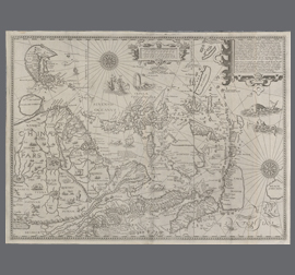
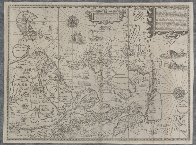
Map of the Chinese Territory and a Precise Description of its Coast Lines.
:::
- 地址:709025臺南市安南區長和路一段250號
- 電話:06-356-8889
- 傳真:06-356-4981
- 無障礙服務專線電話:06-356-8889 分機 8103
- 更新日期:2025-03-24
- 訪客人數:1,592,401
國立臺灣歷史博物館著作權所有 © National Museum of Taiwan History. All Rights reserved.